
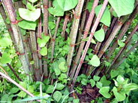
Knotweed is highly invasive and is a very difficult weed to control. It has an enormous root system, which makes manual control methods ineffective and time consuming. One study showed that even when the knotweed stems are cut back to the ground every 4 weeks all summer long for three years, the roots continue to live and send up new shoots. Other studies show that cutting the stems actually stimulates dense re-growth. For this reason, herbicides must be used to effectively control this plant.
Knotweed prefers wet soil and causes the biggest problems near streams where it can quickly take over as high waters and floods distribute it throughout a watershed. Since herbicide use near streams is tricky, we offer help controlling knotweed in these areas. For more detailed information about knotweed’s negative impacts and help identifying it, visit our knotweed page.
Where We Work
Our knotweed control work originally focused on two stream systems: Beaver Creek, a tributary to the Sandy River, and Latourell Creek, which flows into the Columbia River. Begining in 2009 our knotweed control project was expanded outside of these two watersheds, offering free control of all streamside knotweed locations in rural east Multnomah County and also upland locations as time allows.
We Need Your Help
If you live along either of these creeks we are asking for your permission to look for knotweed and to treat it where we find it. Without the cooperation of landowners, we would not be able to protect these creeks from this devastating weed. If you have already granted us permission, thank you. If you have not, please contact us as soon as you can.
Beaver Creek
The Nature Conservancy began working on knotweed control in the Sandy River Watershed in 2001 and their efforts have drastically reduced the amount of knotweed in this watershed. They approached us to ask if we could help out in the lowest and the most urbanized tributary to the Sandy River, Beaver Creek. We agreed and survey and control efforts in the Beaver Creek Watershed began in 2007.
We began by contacting the owners of the 359 properties along Beaver Creek. Over the years we have conducted extensive, riparian surveys on nearly every property and knotweed was found in many locations. Luckily, knotweed’s downstream spread from most of these patches was minor or had not yet occurred. By utilizing The Nature Conservancy’s successful approach, we have been able to reduce the amount of knotweed in the watershed by over 99%. Also, around half the patches now show no new above ground growth. At this point, only very sparse knotweed growth remains in the watershed, is monitored annually and treated as necessary.
This project’s survey and control efforts came just in time. We were able to control the amount of knotweed found within the Beaver Creek Watershed without a huge investment. It would have been much more costly if we had waited another two years or more before beginning our control work. If you have received a mailer from us requesting to survey your property for this weed and have not yet returned a permission form, please contact us as soon as you can.
Latourell Creek
The Latourell Creek Watershed is a small watershed located in the Columbia River Gorge draining just over 2,700 acres and flowing through only 36 properties, 17 of which are privately owned. The watershed’s most well known feature is Latourell Falls, a 249 foot waterfall located just over 2 river miles above the confluence with the Columbia River. Just below the falls, the Creek flows through the eastern edge of the village of Latourell, into a large wetland area and then flows under Interstate 84, entering the Columbia River at the western edge of Rooster Rock State Park. Over 40 percent of the watershed lies within the Columbia River Gorge National Scenic Area.
Knotweed surveys were initiated during the summer of 2008. The owners of all 36 creek side properties were contacted and permission was obtained to survey the creek on all properties but two. Knotweed was found in only four patches on three properties and all patches were at the upper end of the watershed. Although the patches were near the creek, knotweed had not yet invaded the creek bank where it could be dislodged and spread by high waters. One patch was found just in time, a 680 square meter patch was growing just a few meters from one of the headwater springs.
Permission was obtained in the first year to treat all patches found within the watershed and all patches were treated. The four patches treated were all very large, totaling 2,246 square meters, nearly as much as was spread throughout the entire Beaver Creek Watershed prior to our knotweed control project there. All previously treated knotweed patches will be monitored annually and retreated as necessary. Each year, since the original treatments in 2008, at least a few stems have been remained and been treated annually at the four original knotweed locations.
Kntoweed Control in East County
As knotweed surveys in Beaver and Latourell Creeks were largely completed by 2009, free control of knotweed was expanded to all streamside locations in rural, east Multnomah County. Free treatments of upland knotweed patches is also available in some circumstances. Please contact us if you have knotweed growing on your property so we can assess the problem for you and potentially assist you with control.