
The East Multnomah Soil and Water Conservation District serves all of Multnomah County east of the Willamette River. In general terms, the borders of our District are defined by the Columbia River to the North, the Multnomah County-Clackamas County line to the South, the Multnomah County-Hood River County line to the East and the Willamette River to the West.
What’s my zone?
Want to find out which zone you live in? Check out the searchable online map here.
EMSWCD’s service area is divided into three zones. All board positions are elected by all residents of the District regardless of the zone they live in. One board member represents each zone and there are two At-Large positions.
The areas and boundaries of these zones are described below.
-
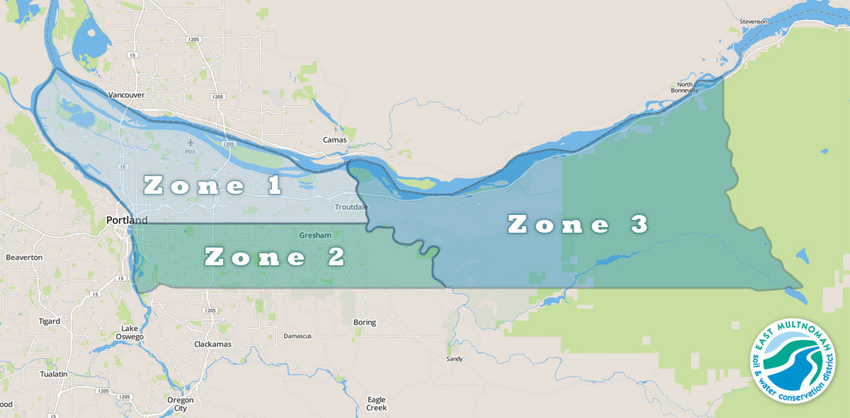
- The East Multnomah Soil and Water Conservation District is divided into three zones, which are shown here.
Zone 1
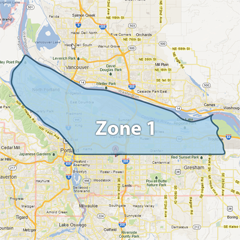 Zone 1 consists of Multnomah County lying north of the Willamette Base Line (Willamette Meridian) from the Willamette River to the Sandy River.
- North: Columbia River, following the line separating Multnomah County, Oregon and Clark County, Washington
- South: Willamette Base Line (T.1N – T.1S township line) Stark Street runs along the Willamette Base Line almost to the Sandy River. Stark Street curves to the south just west of the river. The Base Line continues east. The zone boundary is the Base Line.
- East: The main channel of the Sandy River
- West: The main channel of the Willamette River
Zone 2
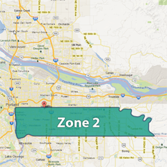 Zone 2 includes all of Multnomah County lying south of the Willamette Base Line from the Willamette River to the Sandy River.
- North: Willamette Base Line (T.1N – T.1S township line)
- South: Multnomah County – Clackamas County line (section line)
- East: The main channel of the Sandy River
- West: The main channel of the Willamette River, Ross Island is included in this zone.
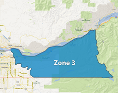
Zone 3
(All original map images are © Google 2013)
Zone 3 comprises all of Multnomah County lying east of the Sandy River.
- North: Columbia River, following the line between Multnomah County, Oregon and Clark County, Washington
- South: Multnomah County-Clackamas County line (section line)
- East: Multnomah County-Hood River County line
- West: The main channel of the Sandy River